



Hiking, 20 km
8.10.2023
 Itálie
 Rakousko
Logged on Vrcholovka 13x in total. Peak information here was completed by Martin Matějka a Milan "Hojší" Průžek.
Weisskugel / Palla Bianca is part of challenges: Austrian Alps, TOP 10 Austria
AT/IT, difficulty II/A-16.I-A
Starting points:
Southeast
The small settlement of Masa Corto (Kurzras - 2004 m) at the end of the Val di Senales valley, located 6 km beyond the Vernago dam. Primarily serves as a winter resort. There are many lifts and cable cars in the area. A key base for reaching the Bella Vista hut.
West
On the western side of the massif, the village of Melag serves as a starting point, located at the end of the Valelunga valley (Langtauferer Tal). A drivable road leads to the village from Lake Lago di Resia (Reschensee), which can be found in the northern tip of South Tyrol near the borders with Austria and Switzerland. Melag is the starting point for the Weisskugel Hütte hut.
South
The last starting point is the end of the Matscher Tal valley, which reaches into the massif from the south. The last parking area is at the Glieshof farm (1807 m). This starting point is very rarely used and is the access point to the Oberetsch Hütte hut. The approach from this side is the most difficult hiking variant for the ascent to Weisskugel.
Ascent routes:
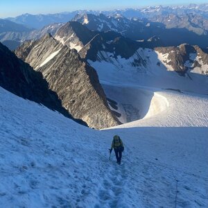
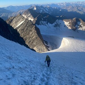
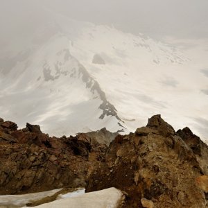
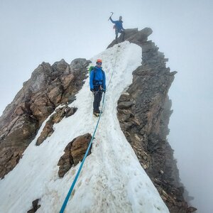
The ascent from the Bella Vista hut - 2842 m is rated at UIAA grade I (F). This applies in good weather. In icy terrain, problems arise on the occasionally rocky ridge. Length: Kurzras - Bella Vista (2 hours) - Palla Bianca (4 hours) - descent 5 hours. Total 11 - 12 hours.
The ascent from the Weisskugel Hütte hut - 2544 m is much more difficult than the previous route. The official difficulty rating is F+. Crossing the Langtauferer Ferner glacier can pose significant challenges due to crevasses or glacier fractures. The routes converge at the Hintereisjoch saddle (3460 m). Length: Melag - Weisskugel Hütte (3 hours) - Palla Bianca (4 hours) - descent the same way 6 hours. Total 12.5 - 13 hours.
The route from the Oberetsch Hütte hut from the small Matscher Tal valley is the most difficult of the hiking routes. The difficulty rating is PD-. Length: Glieshof - Oberetsch Hütte (2.5 hours) - Palla Bianca (4.5 hours) - descent the same way 6 hours. Total 13 hours.
From the north, there is a little-traveled and very long route from the Hochjoch Hospiz hut - 2413 m. It crosses the entire length of the Hintereisferner glacier (7 km) and at the end (many crevasses) connects to other routes at the Hintereisjoch saddle. The official difficulty of this route is F+. Length: Vent - Hochjoch Hospiz (2.5 hours) - Palla Bianca (6 hours) - descent the same way 7 hours. Total 14 - 15 hours.
Good climbers can attempt to conquer the 350-meter-high northern face of the peak. The steepness of the glacial rocky slopes is 55°. The best time for this ascent is early spring to the beginning of summer.
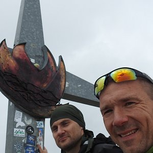
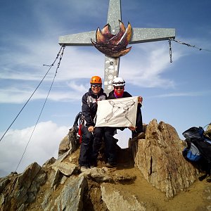
There is a chalet on the peak.
Peak is not stroller accessible.
There are views from the peak.
There is no cable car to this peak.
Special equipment is required for this summit.
Peak is freely accessible.
Nearest peaks: Nordlicher Langtauspitze (3264 m, 1.2 km) Langtauferer Spitze - Punta Vallelunga (3528 m, 1.7 km)
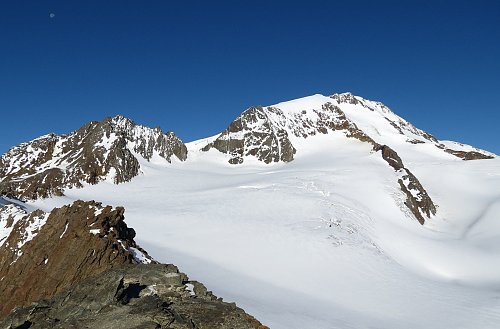
 Kurzras - Maso Corto: Hintereisferner - Blick Richtung Hintere Hintereisspitze
 Schnals - Senales: Schnalstal - Val - Lazaun Bergstation, Richtung Süden
 Schnals - Senales: Schnalstal - Val - Kurzras - Maso Corto, Glockenlift
 Graun - Curon Venosta: Kaunertal - Karlesjoch
| today | tomorrow | day after tomorrow | |
|---|---|---|---|
| Dawn: | 7:13 | 7:15 | 7:16 |
| Sunrise: | 7:44 | 7:46 | 7:47 |
| Sunset: | 18:18 | 18:16 | 18:14 |
| Dusk: | 18:49 | 18:47 | 18:45 |