


Hiking
ne, 14.9.2008


 Bulharsko
Logged on Vrcholovka 2x in total. Vrchol Melnické pyramidy was added here by Bohumír Michal.
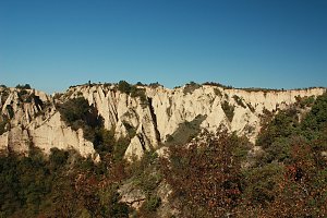
The Melnické pyramidy (Bulgarian: Мелнишки пирамиди) are a protected geological site near the town of Melnik in the Blagoevgrad region of southwestern Bulgaria, close to the border with Greece. The area has been protected as a natural monument since 1960, and in 1978, the area of the protected site was expanded to 1165.6 hectares by a decree of the Committee for Environmental Protection under the Council of Ministers of the People's Republic of Bulgaria.
The site extends in the southwestern foothills of the Pirin Mountains around the town of Melnik and the villages of Karlanovo (Кърланово), Rožen (Рожен), and Sušica (Сушица), which are part of the Sandanski municipality. The protected area is located at an altitude of 350 to 850 meters above sea level.
The area is composed of Pliocene sediments that were eroded from the surrounding higher elevations and deposited at the bottom of a lake that existed at the end of the Neogene in the region between Pirin, the Malashevsko Mountain, Ogražden, and Belasica about 5 to 3 million years ago. The original thickness of the sandstone and conglomerate sedimentary layers was around 500 meters, and these layers, made of relatively soft and unconsolidated material, have been eroded by wind and water for millennia.
The Melnické pyramidy reach heights of up to 100 meters in places. Various geomorphological shapes occur here, such as rock mushrooms, towers, rock needles, and sharp ridges, with the most famous formations located around the village of Karlanovo and near the center of Melnik itself. Due to the ongoing erosion, these shapes are constantly changing.
Source: Wikipedia
There is no chalet on the peak.
Peak is not stroller accessible.
There are views from the peak.
There is no cable car to this peak.
No special equipment is required for this summit.
Peak is freely accessible.
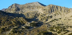
 Výstup k chatě Pirin ve stejnojmenném bulharském pohoří
| today | tomorrow | day after tomorrow | |
|---|---|---|---|
| Dawn: | 6:30 | 6:31 | 6:32 |
| Sunrise: | 6:59 | 7:00 | 7:01 |
| Sunset: | 17:20 | 17:19 | 17:18 |
| Dusk: | 17:49 | 17:48 | 17:46 |

