Hiking, 51 km
5.1.2025
 Česko
Ústí nad Labem (Ústecký kraj)
Logged on Vrcholovka 22x in total. Vrchol Dobětická výšina was added here by Tomik Krejda and info was completed by Martin Matějka a Profesorskey - Jan Bratt.
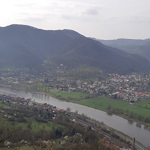
An elliptical peak oriented east-west with a one-kilometer long forested ridge between Dobětice and the village of Žežice. On the southern side, a blue hiking trail runs along the foot of the hill, connecting Dobětice and Žežice, leading all the way to Radešín. On the western side of the ridge, there is a pleasant seating area with several chairs, a table, and a fire pit. From this spot, there is a beautiful view of the Elbe Valley, part of the center of Ústí nad Labem, and especially the Erben Viewpoint.
There is no chalet on the peak.
Peak is not stroller accessible.
There are no views from the peak.
There is no cable car to this peak.
No special equipment is required for this summit.
Peak is freely accessible.
Nearest peaks: Dobětická výšina Z (452 m, 0.6 km) Žežický vršek (410 m, 1 km) Erbenova vyhlídka (420 m, 1.1 km) Pekelský vršek (351 m, 1.1 km) Chuderovský vrch (443 m, 1.2 km) Velký Brand (436 m, 1.2 km) Farský vrch (520 m, 1.3 km) Viniční vrch (236 m, 1.4 km) Hůrka (303 m, 1.6 km) Radešín (550 m, 1.7 km) Mariánský vrch (265 m, 2.2 km) On the Lookout (255 m, 2.3 km) Sedlo (284 m, 3.3 km) U Lesa (514 m, 3.6 km)
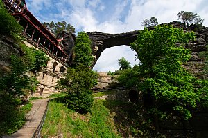 Trek přes Labské pískovce a České Švýcarsko
| today | tomorrow | day after tomorrow | |
|---|---|---|---|
| Dawn: | 6:14 | 6:15 | 6:17 |
| Sunrise: | 6:48 | 6:50 | 6:51 |
| Sunset: | 16:46 | 16:44 | 16:43 |
| Dusk: | 17:20 | 17:18 | 17:17 |