

Hiking, 21 km
30.8.2026
Česko
Bruntál (Moravskoslezský kraj)
Logged on Vrcholovka 46x in total. Peak information here was completed by Martin Matějka, Bouřka a Jiřina.
Kopřivná is part of challenge: Thousands of Jeseníky Mountains
One of the secondary peaks of Temná. Geodetic point near the path.
There is no chalet on the peak.
Peak is not stroller accessible.
There are no views from the peak.
There is no cable car to this peak.
No special equipment is required for this summit.
Peak is freely accessible.
Nearest peaks: Kopřivná SZ (1017 m, 0.2 km) Skály pod Kopřivnou (1027 m, 0.5 km) Kámen Svobody (924 m, 1 km) Malý Máj JV (903 m, 1.1 km) Kámen Svobody J (892 m, 1.4 km) Kosov (905 m, 1.5 km) Malý Máj (1082 m, 1.9 km) Klobouk (960 m, 2.3 km) Temná (1263 m, 2.4 km) At the Furnaces J (849 m, 2.6 km) Nad Kapličkou (761 m, 2.6 km) U pecí (850 m, 2.6 km) U Peci SZ (841 m, 2.6 km) Kapličkový vrch (733 m, 2.8 km) V Javořinách (850 m, 2.8 km) Solný vrch (819 m, 3.2 km)
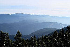
 Malá Morávka: Kopřivná Pradědem
 Mala Moravka: Kopřivná
 Mala Moravka: Kopřivná
 Karlov
 Karlov pod Pradedem: Ski Karlov - areál Karlov - Sportovní
 Karlov pod Pradedem: Ski Karlov - areál Karlov - Sjezdovky V Javořinách a Rodinná
 Karlov pod Pradedem: Ski Karlov - areál Karlov - Vyhlídková
 Mala Moravka
 Mala Moravka: Hlavní sjezdovka Skicentrum Pawlin Karlov
 Karlova Studanka: Lyžařský vlek - Sjezdovka
 Mala Moravka: Praděd - Horský hotel Volareza - Horská služba
 Mala Moravka: Praděd - Horský hotel Volareza
 Mala Moravka: Praděd - Horský hotel Volareza - Bílá Opava
 Mala Moravka: Praděd - Horský hotel Volareza - Petrovy kameny
 Nova Ves u Rymarova: Chata Myslivna SKP Olomouc - Běžecký lyžařský areál Nová Ves
 Nova Ves u Rymarova: Chata Myslivna SKP Olomouc - Běžecký lyžařský areál Nová Ves - horní část
 Nova Ves u Rymarova: Chata Myslivna SKP Olomouc - Posezení
 Nova Ves u Rymarova: Chata Myslivna SKP Olomouc - Pohled do krajiny
 Vaclavov u Bruntalu › South
 Rejhotice: Sporthotel Kurzovní - Vysoké hole
 Rejhotice: Sporthotel Kurzovní - Přístup na běžeckou trať
 Rejhotice: Sporthotel Kurzovní - Parkoviště a hlavní vchod
 Rejhotice: Sporthotel Kurzovní - Petrovy kameny
 Karlova Studánka: Sporthotel Kurznovní

| today | tomorrow | day after tomorrow | |
|---|---|---|---|
| Dawn: | 6:16 | 6:17 | 6:19 |
| Sunrise: | 6:50 | 6:52 | 6:53 |
| Sunset: | 16:18 | 16:16 | 16:15 |
| Dusk: | 16:52 | 16:51 | 16:50 |