Hiking, 6 km
31.8.2025
 Česko
Česká Lípa (Liberecký kraj)
Logged on Vrcholovka 21x in total. Vrchol Rokytská horka was added here by Milan "Hojší" Průžek and info was completed by Martin Matějka a Petr Wendler.
Rokytská horka is part of challenge: Czech Crown
Rokytská horka (410 m a.s.l.), also known simply as Horka, is a hill on the edge of the Česká Lípa district and the Liberec region, located 2 km north of Horní Rokytá, in the cadastral area of the settlement Jabloneček. It is the highest peak of the entire Jizera Table.
The southern, steepest slope of Rokytská horka
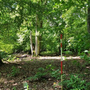
At the summit, there are small pit mines and sparse volcanic debris. Views of the Mladoboleslavsko region are only possible from the southern grassy slope. 400 meters from the summit, there is a fence of the Židlov game reserve, which can be crossed using so-called overpasses. Within a 2-kilometer radius to the north in the Židlov game reserve (already in the neighboring Českodubská Highlands), there are two similar hills with similar height and names, Židlovská horka (409 m) and Prosíčská horka (408 m).
There is no chalet on the peak.
Peak is not stroller accessible.
There are no views from the peak.
There is no cable car to this peak.
No special equipment is required for this summit.
From Mukařov, you can drive to the parking lot in the forest. The ascent is along an unmarked forest path that is almost flat. Before reaching the summit, it is necessary to navigate using GPS coordinates on mapy.cz. There is no beaten path leading to the summit point, but it can be found using GPS.
Nearest peaks: Prosíčská horka (408 m, 1.8 km) Židlovská horka (410 m, 1.9 km) Orlí (381 m, 2.1 km)
| today | tomorrow | day after tomorrow | |
|---|---|---|---|
| Dawn: | 6:11 | 6:12 | 6:14 |
| Sunrise: | 6:44 | 6:46 | 6:48 |
| Sunset: | 16:43 | 16:41 | 16:40 |
| Dusk: | 17:17 | 17:15 | 17:14 |