Krzemień (1335 m a.s.l., Bukovské vrchy)
Register and log summit


About peak Krzemień
 Polsko
Logged on Vrcholovka 6x in total. Vrchol Krzemień was added here by Horalka Anička and info was completed by Malek Belhadj, Alexandr Starý, Rastislav Biarinec a Martin Matějka.
The second highest mountain in the Polish part of the Bukovské Hills (Bieszczady). The elongated summit ridge is crowned with a series of rocks and boulders.
- Chalet/accommodation
-
There is no chalet on the peak.
- Stroller access
-
Peak is not stroller accessible.
- Views
-
There are views from the peak.
- Cable car
-
There is no cable car to this peak.
- Equipment
-
No special equipment is required for this summit.
- Accessibility
-
BPN - there is no marked hiking trail leading to the summit. A marked hiking trail passes near the summit, but the summit itself is not accessible (it is located in a national park).
Nearest peaks: Krzemień JV1 (1318 m, 0.4 km) Bukowe Berdo (1311 m, 0.8 km) Krzemień JV2 (1286 m, 0.8 km) Tarniczka (1315 m, 1.3 km) Kopa Bukowska (1319 m, 1.4 km) Połonina Dźwiniacka (1238 m, 1.5 km) Tarnica (1346 m, 1.5 km) Tarniczka Z (1292 m, 1.6 km) Szeroki Wierch (1268 m, 2 km) Wierszek Jeleni (1271 m, 2.2 km) Szołtynia (1201 m, 2.3 km)
Routes nearby
Routes provided by SvetOutdooru.cz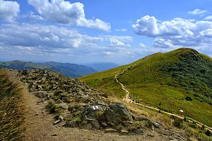
Mountain chalets


Sun
| today | tomorrow | day after tomorrow | |
|---|---|---|---|
| Dawn: | 6:31 | 5:32 | 5:34 |
| Sunrise: | 7:03 | 6:05 | 6:06 |
| Sunset: | 17:22 | 16:20 | 16:19 |
| Dusk: | 17:55 | 16:53 | 16:51 |