




Hiking
pá, 19.6.2026, 14:15
 Rakousko
Logged on Vrcholovka 1x in total. Vrchol Selbhorn was added here by Milan "Hojší" Průžek.
Selbhorn is part of challenge: King of the Berchtesgaden Alps
Selbhorn, at an elevation of 2,655 m (AA), is the highest mountain of Steinernes Meer, a subrange of the Berchtesgaden Alps. It is located in the Austrian state of Salzburg, near the border with Germany.
A long, physically demanding mountain and via ferrata trip to the highest peak of Steinernes Meer with an elevation gain of around 2000 m. The via ferrata, rated C-D in difficulty, and the overall scenery make this trip a great climbing circuit.
The via ferrata runs along the 400-meter-high southwest face of the mountain, which can only be reached after a long walk. The via ferrata largely follows the old Herzogsteig, where difficult passages were previously secured with steel cables and brackets. The enormous karst landscape, as well as the untouched, very solitary nature (there is neither a hut nor a shelter at the upper part of the ascent), characterize this great via ferrata tour.
ASCENT:
Follow the signs to Lechneralm. Do not go directly to the mountain hut, but take the alpine road below the building around the cattle gate back to the hunting lodge. Continue here to the Braggstein junction. Over a ridge covered with pines, continue to the junction where you turn left and ascend below the southern ridge of Selbhorn. The turnoff to the via ferrata is marked by a stone man. If you follow the trail here, you will reach a grassy terrace with a bench and arrive at the entrance to the via ferrata.
PP(900) - Braggstein - Entrance (2250): 2.5 - 3.5 hours.
Entrance - Selbhorn-Südgipfel (2643): approx. 2 hours (400 m elevation gain)
Südgipfel - Nordgipfel (2654): approx. 15 minutes
Total ascent time: 4.5 - 6 hours.
DESCENT:
We descend through scree and slabs to the summit saddle. A short rock step (B) is climbed up secured with a rope, then back to walking terrain. A little way down the western slope of the main peak, we deviate from the descent path to the right and climb over short blocks to the beautiful summit cross of the main peak (2655 m) above. Back down to the descent path. A long, boulder-covered strip of rock in the western face of the northern peak leads partially down over the karst surface of Steinernes Meer via a steel cable. Through the gripping plates of carts and boulders, we go to Luegscharte. Here, the possible descent paths are divided:
The official recommended descent leads right around Mandlköpfe in typical high karst with a slight ascent to Buchauerscharte. A steep but easy hiking trail leads around Freithofalm and below it down the cart path with shortcuts into Krallerwinkel. A visit to Kasereggkapelle is worth it.
A somewhat more challenging variant leads from Luegscharte in a scree basin and scree slopes below the western face of Selbhorn somewhat laboriously and exposed to the entrance of the via ferrata. Now, after the ascent back to Braggstein and down to the rustic Lechneralm, which invites you to stop.
Selbhorn-Nordgipfel - Luegscharte (2448): approx. 0.5-1 hour.
Luegscharte - Buchauer Scharte (2270): 0.5 - 1 hour.
Buchauer Scharte - Freithofalm (1555) - PP: approx. 2 - 2.5 hours.
Total descent time: 3 - 4 hours.
Total duration approximately 7.5 - 10 hours.
In early summer, crampons and ice axes may be necessary.
The via ferrata is recommended only for experienced, confident, and enduring via ferrata tourists.
Ascend only in stable weather, with an early start and sufficient drinking supplies.
The descent via Luegscharte leads through steep, rocky terrain interspersed with scree. If you are unsure, you should definitely descend via Buchauerscharte.
Below Luegscharte, snow in the steep cirque often lasts until early summer. If you encounter old snow during the ascent and travel without ice axes and crampons, you should rather turn back.
Selbhorn, along the cables up to the clouds
TO AUSTRIA FOR VIA FERRATAS II. - SELBHORN-KLETTERSTEIG-HERZOGSTEIG C/D AND KÖNIGSJODLER D
There is no chalet on the peak.
Peak is not stroller accessible.
There are views from the peak.
There is no cable car to this peak.
In case of snow, crampons and ice axes ... even in early summer
Peak is freely accessible.
Nearest peaks: Selbhorn Südgipfel (2642 m, 0.3 km) Hochstreif (2542 m, 0.8 km) Bonegg (2559 m, 1.1 km) Scharegg (2570 m, 1.6 km) Schwarze Schneid (2565 m, 1.6 km) Braggstein (1827 m, 1.8 km) Hochbrunnsulzenkopf (2432 m, 2.1 km) Wildalmkirchl (2573 m, 2.2 km) Schönfeldspitze (2653 m, 2.3 km)
 Lehká túra k nejvyššímu německému vodopádu s plavbou přes Königssee
 Výstup na Hochkönig
 Trek Berchtesgadenskými Alpami
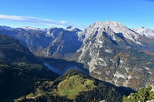 Túra z Jenneru na Schneibstein a k jezírku Seeleinsee

 Schonau am Konigssee: Kärlingerhaus am Funtensee - Blick nach Südosten
 Maria Alm am Steinernen Meer: Maria Alm, Hochkönig - Natrun Bergstation
 Maria Alm am Steinernen Meer: Maria Alm, Hochkönig - Bergstation Hochmais
 Aberg: Maria-Alm 360°

| today | tomorrow | day after tomorrow | |
|---|---|---|---|
| Dawn: | 6:09 | 6:11 | 6:12 |
| Sunrise: | 6:41 | 6:42 | 6:44 |
| Sunset: | 17:03 | 17:01 | 16:59 |
| Dusk: | 17:34 | 17:32 | 17:31 |