




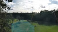




Cycling, 33 km
23.4.2023
 Česko
Teplice (Ústecký kraj)
Logged on Vrcholovka 7x in total. Vrchol Pod Dráhou was added here by Tomik Krejda and info was completed by Martin Matějka a Tor.
An inconspicuous wooded hill at the southeastern end of an elongated ridge, culminating in an unnamed peak at an elevation of 520m to the northwest. To the east, it gently descends into the Císařská elevation, while steep southwestern cliffs drop sharply into the valley of the Mstišovský stream. From the forest clearings at the summit, only the highest peaks of the Cínovec mountains can be glimpsed to the east.
There is no chalet on the peak.
Peak is not stroller accessible.
There are no views from the peak.
There is no cable car to this peak.
No special equipment is required for this summit.
Peak is freely accessible.
Nearest peaks: Mstišovský vršek (420 m, 0.8 km) Terezina výšina (517 m, 0.8 km) Mlýnský vrch (436 m, 1 km) Above the Stone Sea (535 m, 1.1 km) Nad Bystřicí (521 m, 1.1 km) Goethův vrch (492 m, 1.2 km) Knížecí vršek (499 m, 1.3 km) Ptačí vrch (506 m, 1.3 km) Strážný vrch (470 m, 1.3 km) Dubský kopec (433 m, 1.8 km) Husův vrch (366 m, 1.8 km) Židovský vrch (620 m, 2.2 km) Vlčí hůrka (556 m, 2.3 km) Spáleniště (693 m, 2.5 km) Parohy (730 m, 3.2 km) Kutný vrch (763 m, 3.3 km)
| today | tomorrow | day after tomorrow | |
|---|---|---|---|
| Dawn: | 7:09 | 6:10 | 6:12 |
| Sunrise: | 7:42 | 6:44 | 6:46 |
| Sunset: | 17:55 | 16:53 | 16:51 |
| Dusk: | 18:29 | 17:27 | 17:25 |







