





Running, 24 km
3.1.2025
 Česko
Strakonice (Jihočeský kraj)
Logged on Vrcholovka 3x in total. Vrchol Kůstrý was added here by Bouřka and info was completed by Vladimír Grančay.
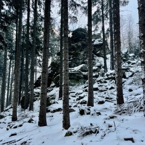
The geodetic point (granite marker) is located in a dense, overgrown forest, and the geodetic rod is only half-length, buried about 3 meters from the geodetic point.
There is no chalet on the peak.
Peak is not stroller accessible.
There are no views from the peak.
There is no cable car to this peak.
No special equipment is required for this summit.
Peak is freely accessible.
Nearest peaks: Altán (845 m, 0.3 km) Malý Altán (797 m, 0.6 km) Kváskovický kopec (820 m, 0.9 km) Roviny (774 m, 1.1 km) Nad Mačurou (798 m, 1.2 km) Nad Paloučky (824 m, 1.2 km) Na Žářích (657 m, 1.6 km) Zahájený SV (833 m, 1.6 km) Nad Biskupem (810 m, 1.8 km) Novoveský vrch (765 m, 1.9 km) At the Water Reservoir (746 m, 2 km) Malečská hora (833 m, 2.1 km) Zahájený (846 m, 2.1 km) Nad Vsí JV (829 m, 2.3 km) Nad Novou Vsí (639 m, 2.5 km) Na Březinách (622 m, 2.6 km) Zahájený JV (774 m, 2.6 km) Na Pláni V (716 m, 2.7 km) Vrbí (715 m, 2.7 km) Na Březinách SZ (626 m, 2.8 km) In Zahájeném (754 m, 2.9 km) Na Zahradách (580 m, 2.9 km) Na Pláni (737 m, 3 km) Pahorky (605 m, 3.3 km)
| today | tomorrow | day after tomorrow | |
|---|---|---|---|
| Dawn: | 6:09 | 6:10 | 6:12 |
| Sunrise: | 6:41 | 6:43 | 6:44 |
| Sunset: | 16:56 | 16:55 | 16:53 |
| Dusk: | 17:29 | 17:27 | 17:26 |




