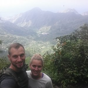
Hiking, 5 km
21.3.2024

 Indonésie
Logged on Vrcholovka 9x in total. Vrchol Gunung Bisbis was added here by Jan Čech and info was completed by Jan Čech, Martin Matějka a Jirka Hruška.
At the summit, there is the Hindu temple Lempuyang, which is accessed by more than 1700 steps. The ascent is possible from three sides - from the east via the famous heavenly gate of the temple Pura Penataran Agung Lempuyang along 1700 steps (entrance fee of 70,000 IDR required), or from the southeast from the temple Pura Lempuyang Madya also via steps (free), or from the south from the temple Pura Penataran Pucak Gunung Kembar-Kenusut in the village of Jumenang. Watch out for monkeys along the way. Traditional Balinese clothing is required for entry to the temples along the way, and offerings should be brought.
There is no chalet on the peak.
Peak is not stroller accessible.
There are views from the peak.
There is no cable car to this peak.
No special equipment is required for this summit.
Peak is freely accessible.
Nearest peaks: Gunung Lempuyang (982 m, 0.3 km) Bukit Madya (768 m, 1 km) Gunung Seraya (1175 m, 1.2 km) Bukit Jumenang (635 m, 1.3 km) Bukit Sega (586 m, 1.9 km) Bukit Lingga Manik (508 m, 2 km) Gunung Sega (758 m, 2.1 km) Bukit Watu Pondong-pondong (575 m, 2.3 km) Gunung Tabuan (757 m, 2.3 km) Bukit Lahanan (666 m, 2.4 km) Bukit Endolang (479 m, 2.5 km) Bukit Lingga Jati (702 m, 2.6 km) Mount Bagas (813 m, 2.6 km) Bukit Cangwang (356 m, 3 km) Bukit Tabuan (445 m, 3 km) Gunung Maspait (901 m, 3 km) Bukit Lahangan (751 m, 3.1 km) Bukit Bantul (509 m, 3.2 km) Bukit Tuba (509 m, 3.2 km) Bukit Mapit (769 m, 3.3 km) Bukit Samuh (468 m, 3.3 km) Balang Bay (549 m, 3.4 km) Bukit Base (462 m, 3.4 km) Bukit Bunutan (323 m, 3.4 km) Bukit Biadan (595 m, 4.1 km) Bukit Bluhbuh (537 m, 4.1 km) Bukit Penaban (268 m, 4.1 km)
| today | tomorrow | day after tomorrow | |
|---|---|---|---|
| Dawn: | 5:28 | 5:28 | 5:27 |
| Sunrise: | 5:49 | 5:49 | 5:49 |
| Sunset: | 18:12 | 18:12 | 18:12 |
| Dusk: | 18:34 | 18:34 | 18:34 |