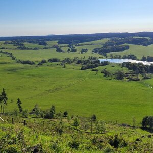

Hiking, 1 km
11.8.2024
 Česko
Plzeň-sever (Plzeňský kraj)
Logged on Vrcholovka 4x in total. Vrchol Soudný was added here by Bouřka and info was completed by Martin Matějka.
Soudný is part of challenge: Crown of Regions and Districts
A vast flat peak near Ostřetín, the highest point in the Plzeň-sever district. It is not explicitly named on maps, and one can only encounter the local name Soudný, which evidently refers to the entire massif. The geodetic point with an elevation of 727.0m is approximately 700m east-southeast of the highest point, which according to ags.cuzk.cz reaches an elevation of 728.1m.
There is no chalet on the peak.
Peak is not stroller accessible.
There are views from the peak.
There is no cable car to this peak.
No special equipment is required for this summit.
Peak is freely accessible.
Nearest peaks: Mlýnské pole (719 m, 1.4 km) U Staré skládky (718 m, 1.5 km) Žernovnický vrch (697 m, 1.9 km) Nad Bofortem (722 m, 2.1 km) Soudný J (680 m, 2.1 km) U Remízku (693 m, 2.1 km) Saskův kopec (679 m, 2.3 km) Sepuska (721 m, 2.3 km) Ovčí hora S (688 m, 2.6 km) Ovčí hora (691 m, 3.2 km)
| today | tomorrow | day after tomorrow | |
|---|---|---|---|
| Dawn: | 6:12 | 6:14 | 6:15 |
| Sunrise: | 6:45 | 6:47 | 6:49 |
| Sunset: | 16:57 | 16:56 | 16:54 |
| Dusk: | 17:31 | 17:29 | 17:27 |